·
 ·
17 min read
·
17 min read
Riding Israel: the Golan Heights
Since the beginning of this series, we have been exploring the North of Israel. We began with the Western Galilee and continued with Upper Galilee. We have two more items in the North before we continue to the Central Israel and later to the South.

As said above, today we leave for a moment the Galilee, in order to visit the Golan Heights.
A little of the history of the place
The Golan Heights are a mountain chain higher than most of the area where they are placed, in which we can find history of up to pre-historical dates. It's Jewish settling history is also very long, but after being expelled from there, Jews began to come back to the Golan Height in the later 1800's.
Since the declaration of the independence of Israel, and until 1967, the towns and villages in the Upper and Lower Galilee suffered constant shelling from the heights of the mountains in the Golan, which was under Syrian control since the Independence war, when jews were expelled from there and moved to Israel. The Syrian made use of the height of the mountains to keep control and shell every movement they could see in the newly created country.
In June 1967, with the beginning of the 6-Day War, shelling became too heavy to accept, and the Israeli army decided to take control of the area. Two days after the beginning of the war, the army conquered on June 8th the Golan heights and, even though they could continue until Damascus on that same day, they stopped at the point that prevented from the Syrian to keep watching and attacking from the top the Israeli villages and towns, and at the last point which had history of Jewish settlements. At the cease fire agreements, the new borderline between the countries was set to that place, although the Syrian government never accepted that.
In 1973, at the Yom Kippur war, a new Syrian attack was launched in order to reconquer the area. The attack was carried at Yom Kippur, the most sacred day of the Jewish calendar, and took the Israelis by surprise while most of the forces were at synagogues around the country. It was also a coordinated attack with the Egyptians in the South. Although Israel lost much ground in the first days, at the end of the war they were already near Damascus and 60 kilometers from Cairo. At the cease-fire agreement, Israel returned to the same lines it was at the beginning of the war, and this marks the first time in history in which a country that was attacked by its neighbours and managed to turn the battle and conquer the attacker's lands, accepts to return to the previous border and give back the land conquered to the attacker. If we try to compare this to current conflicts, it would be the same as Ukraine managing to arrive to Volgograd and near Moscow and at the end of the war agreeing to return to the current borders at Kharkiv and Mariupol.
So, let's begin our tour!
There is a lot to see in the Golan Heights. From waterfalls, lakes and vegetation, through Kibbutzim, Jewish and Druze towns, and up to interesting archaeological sites. The roads are awesome for motorcycling, and we will almost never meet heavy traffic on them. Distances are not exceptionally long, so there are always stops and visitations do be done.
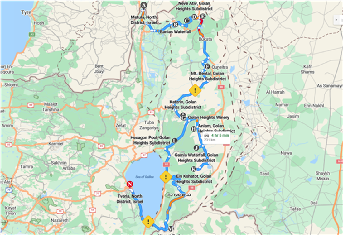
We will begin our tour from the point we stopped last time, our sleeping site in Metula, which is at the very border between the upper Galilee and the Golan Heights. You can see it in the map above as point A. Our first destination will be the Banias Waterfall at point B.
Banias Waterfall
From Metula we take Road 90 for some 8 Km until the Northern entry to Kyriat Shemona, and there we take a right to Road 99. If you have not done the Banias Kayak or Rafting during your stay in Metula, this is a second chance to do it, by making a stop at Hagoshrim, Beit Hilel, or Ma'ayan Baruch for that. After that, or if decided not to stop, we can continue on Road 99 until we arrive near Kibbutz Snir, and the road does some sharp Curves, there you will find the entry to the Banias Falls. We are talking about a total of 12Km and that should take some 25 minutes from Metula or 10 minutes from any of the rafting sites.
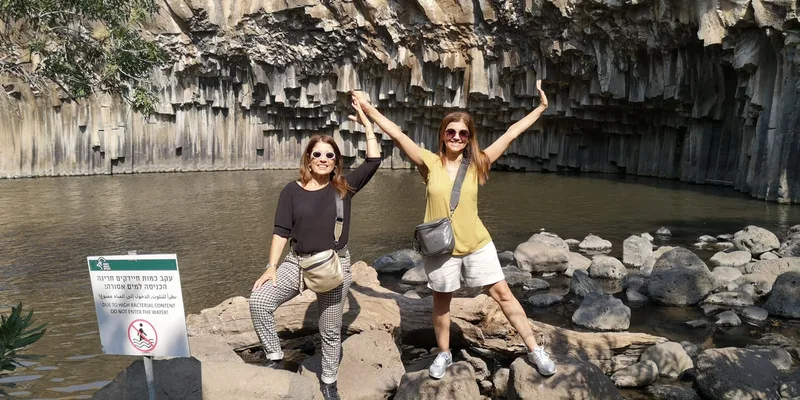
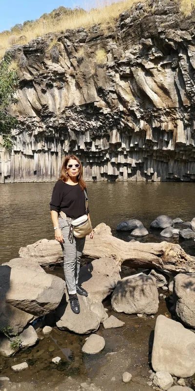
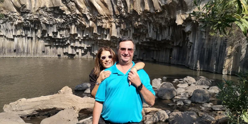
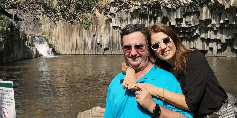
There is a parking lot for the Banias Falls, where you can park the bikes and go for a walk through the place.
You can see below some pictures of the site. You can click the picture to see it in full size. In the continuation, a map of the way from Metula to there. Clicking on "More options" in the map will take you to Google Maps to see it at full size and details.
The Golan Heights are a mountain chain higher than most of the area where they are placed, in which we can find history of up to pre-historical dates. It's Jewish settling history is also very long, but after being expelled from there, Jews began to come back to the Golan Height in the later 1800's.
Since the declaration of the independence of Israel, and until 1967, the towns and villages in the Upper and Lower Galilee suffered constant shelling from the heights of the mountains in the Golan, which was under Syrian control since the Independence war, when jews were expelled from there and moved to Israel. The Syrian made use of the height of the mountains to keep control and shell every movement they could see in the newly created country.
In June 1967, with the beginning of the 6-Day War, shelling became too heavy to accept, and the Israeli army decided to take control of the area. Two days after the beginning of the war, the army conquered on June 8th the Golan heights and, even though they could continue until Damascus on that same day, they stopped at the point that prevented from the Syrian to keep watching and attacking from the top the Israeli villages and towns, and at the last point which had history of Jewish settlements. At the cease fire agreements, the new borderline between the countries was set to that place, although the Syrian government never accepted that.
In 1973, at the Yom Kippur war, a new Syrian attack was launched in order to reconquer the area. The attack was carried at Yom Kippur, the most sacred day of the Jewish calendar, and took the Israelis by surprise while most of the forces were at synagogues around the country. It was also a coordinated attack with the Egyptians in the South. Although Israel lost much ground in the first days, at the end of the war they were already near Damascus and 60 kilometers from Cairo. At the cease-fire agreement, Israel returned to the same lines it was at the beginning of the war, and this marks the first time in history in which a country that was attacked by its neighbours and managed to turn the battle and conquer the attacker's lands, accepts to return to the previous border and give back the land conquered to the attacker. If we try to compare this to current conflicts, it would be the same as Ukraine managing to arrive to Volgograd and near Moscow and at the end of the war agreeing to return to the current borders at Kharkiv and Mariupol.
So, let's begin our tour!
There is a lot to see in the Golan Heights. From waterfalls, lakes and vegetation, through Kibbutzim, Jewish and Druze towns, and up to interesting archaeological sites. The roads are awesome for motorcycling, and we will almost never meet heavy traffic on them. Distances are not exceptionally long, so there are always stops and visitations do be done.
We will begin our tour from the point we stopped last time, our sleeping site in Metula, which is at the very border between the upper Galilee and the Golan Heights. You can see it in the map above as point A. Our first destination will be the Banias Waterfall at point B.
Banias Waterfall
From Metula we take Road 90 for some 8 Km until the Northern entry to Kyriat Shemona, and there we take a right to Road 99. If you have not done the Banias Kayak or Rafting during your stay in Metula, this is a second chance to do it, by making a stop at Hagoshrim, Beit Hilel, or Ma'ayan Baruch for that. After that, or if decided not to stop, we can continue on Road 99 until we arrive near Kibbutz Snir, and the road does some sharp Curves, there you will find the entry to the Banias Falls. We are talking about a total of 12Km and that should take some 25 minutes from Metula or 10 minutes from any of the rafting sites.
There is a parking lot for the Banias Falls, where you can park the bikes and go for a walk through the place.
You can see below some pictures of the site. You can click the picture to see it in full size. In the continuation, a map of the way from Metula to there. Clicking on "More options" in the map will take you to Google Maps to see it at full size and details.
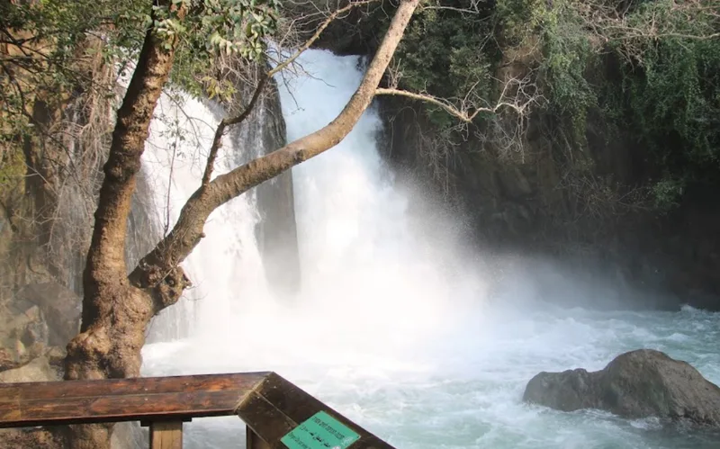
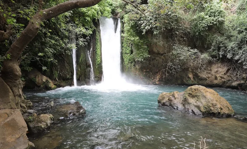
There are diverse ways to walk there, you should be prepared to walk for around 1-1.5 hours. You should note though that if you are coming to visit in the period September-October it will have much less water than in the earlier months of the year.
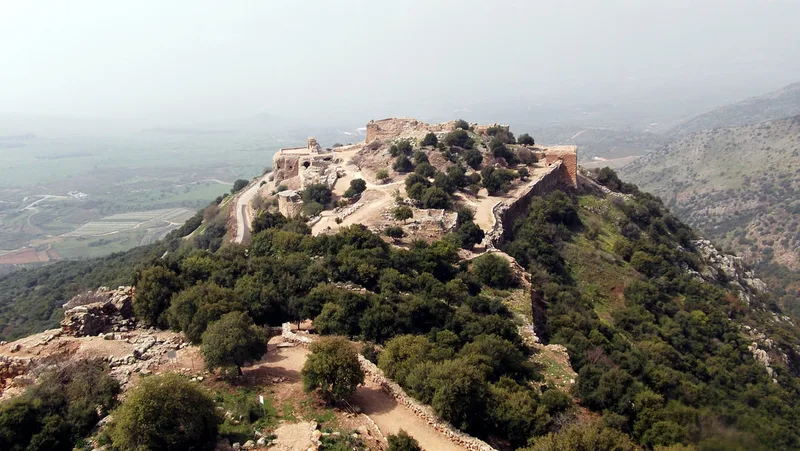
Nimrod Fortress
From Wikipedia:
Nimrod Fortress
From Wikipedia:
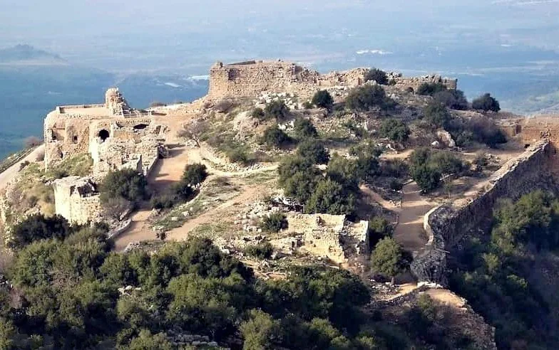
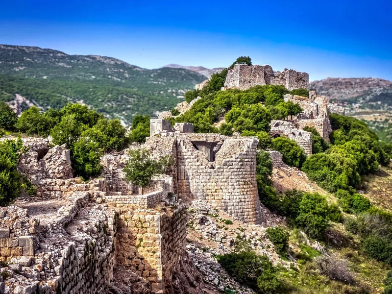
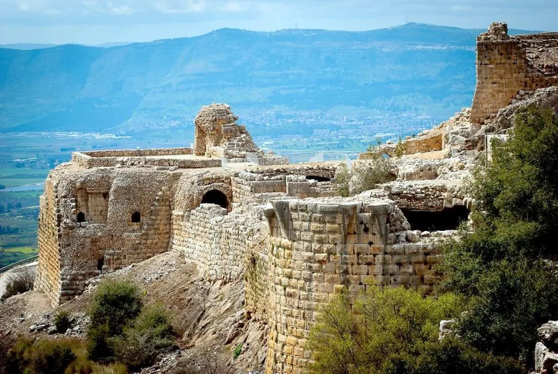
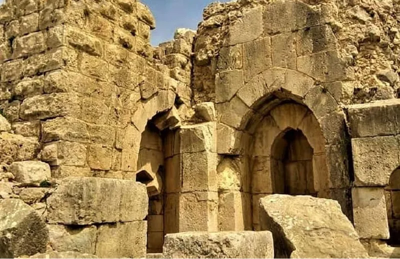
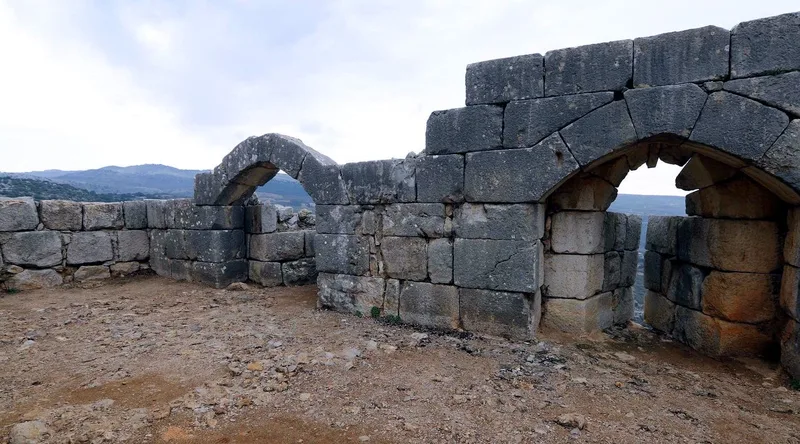
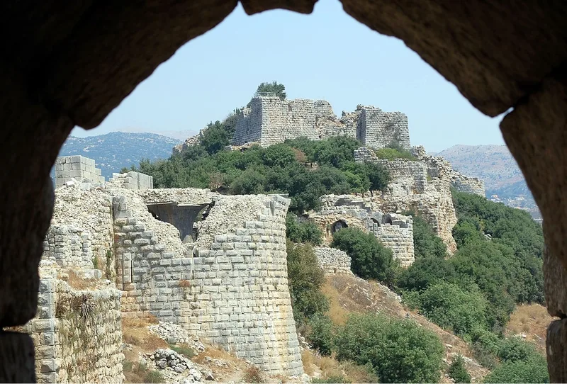
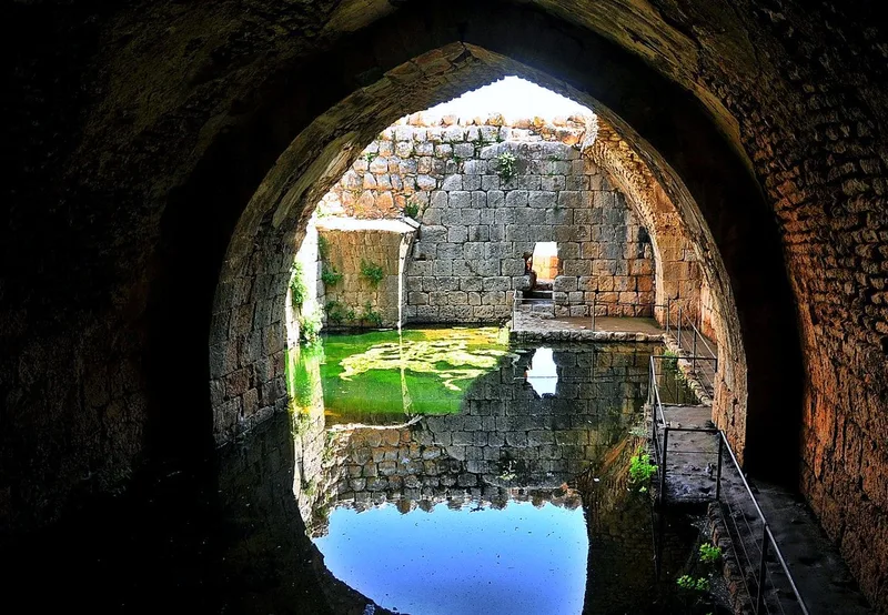
The Nimrod Fortress or Nimrod Castle (Arabic: قلعة الصبيبة Qal'at al-Subeiba, "Castle of the Large Cliff", later Qal'at Namrud, "Nimrod's Castle"; Hebrew: מבצר נמרוד, Mivtzar Nimrod, "Nimrod's Fortress") is a castle built by the Ayyubids and hugely enlarged by the Mamluks, situated on the southern slopes of Mount Hermon, on a ridge rising about 800 m (2600 feet) above sea level. It overlooks the Golan Heights and was built with the purpose of guarding a major access route to Damascus against armies coming from the west.
Alternative forms and spellings include: Kal'at instead of Qal'at, the prefix as- instead of al-, and Subayba, Subaybah and Subeibeh in place of Subeiba.
History
According to geological observations and archaeological findings, the Nimrod Fortress (Nimrod's Celt) in the Golan was first built in the Hellenistic period (up to 30 AD) or the Byzantine period (4th to 7th century AD).[2]
The fortress was rebuilt[3] around 1228 by Al-Aziz Uthman, the son of Saladin's brother al-'Adil, to preempt an attack on Damascus by the armies of the Sixth Crusade.[4][5] It was named Qal'at al-Subeiba, "Castle of the Large Cliff" in Arabic. The fortress was further expanded to contain the whole ridge by 1230. In 1260 the Mongols captured the castle, dismantled some of its defenses and left their ally, the son of Al-Aziz 'Uthman, in charge of it and the nearby town of Banias.[6] After the subsequent Mamluk victory over the Mongols at the Battle of Ain Jalut, Sultan Baibars strengthened the castle and added larger towers. The fortress was given to Baibars's second-in-command, Bilik. The new governor started the broad construction activities. When the construction was finished, Bilik memorialized his work and glorified the name of the sultan in a 1275 inscription. After the death of Baibars, his son arranged for Bilik to be murdered, apparently because he feared his power.
At the end of the 13th century, following the Muslim conquest of the port city of Acre (Akko) and the end of Crusader rule in the Holy Land, the fortress lost its strategic value and fell into disrepair.
The Ottoman Turks conquered the land in 1517 and used the fortress as a luxury prison for Ottoman nobles. The fortress was abandoned later in the 16th century and local shepherds and their flocks were the sole guests within its walls.
The fortress was significantly damaged by an earthquake in 1759 that hit the region.[7]
Druze who came to the region during the 1860 conflict between themselves and the Maronites began calling it Qal'at Namrud (Nimrod's Castle),[8] anachronistically attributing it to the Biblical Nimrod.
Take the bikes from the Banias Waterfalls parking lot, return to Road 99 to the right (going East) and continue until the junction with Road 989, where you will take a left to this road. The itinerary takes 13 minutes and is 8.4 Km long.
This will be another interesting visit to walk through and spend some time on.
This will be another interesting visit to walk through and spend some time on.
Mount Hermon
From Nimrod Fortress we will continue through road 989, pass through the Neve Ativ moshav, continue through the road until the Druze city of Majdal Shams, and from there up to Mount Hermon.
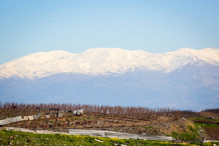
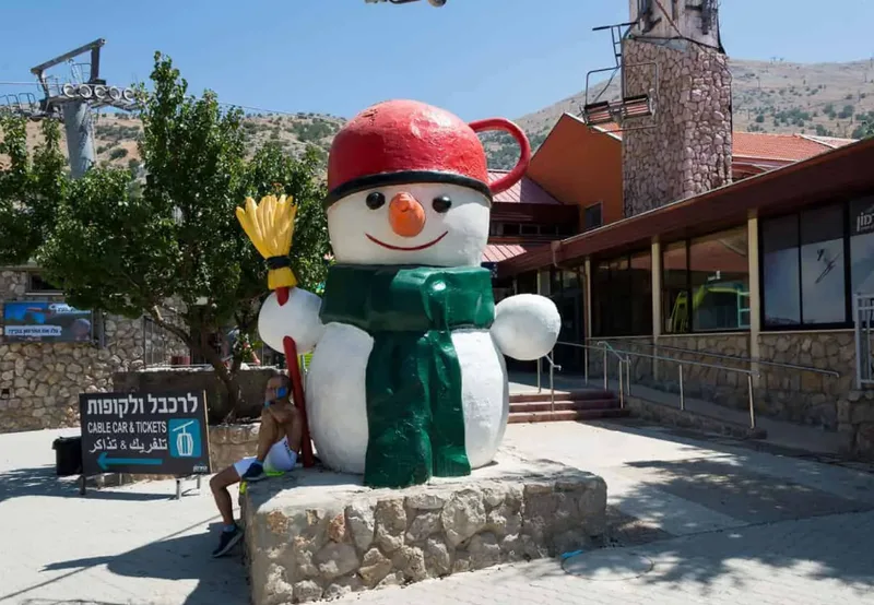
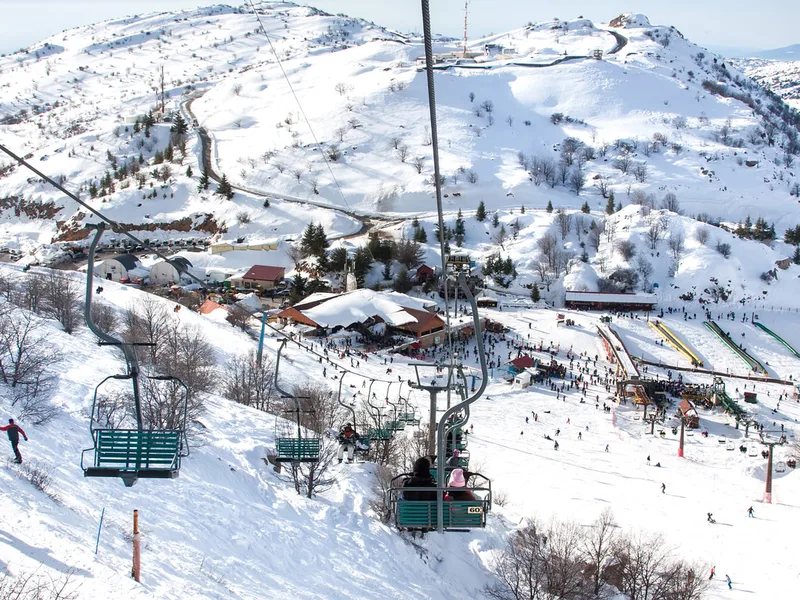
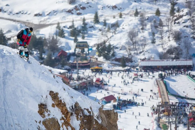
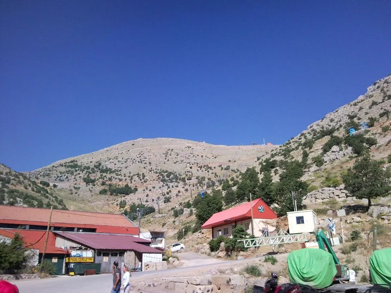
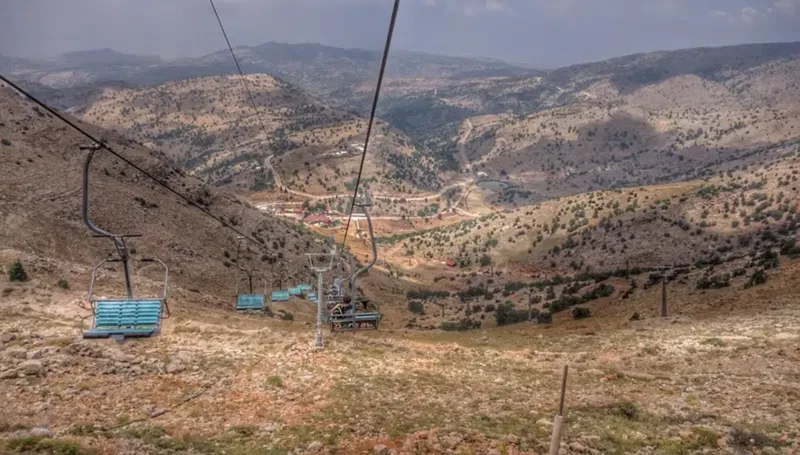
Mount Hermon is the pearl of the Golan Heights. With its 2,040 meters of height, it is the highest mountain in Israel and can be seen from many places in the area; in clear days one can see from there all the Golan Heights and the Upper Galilee, and sometimes even the Lower Galilee with the Kinneret Lake (aka Sea of Galilee). It is one of the only places in Israel which gets covered with snow during a big part, so naturally is the only Israeli ski resort.
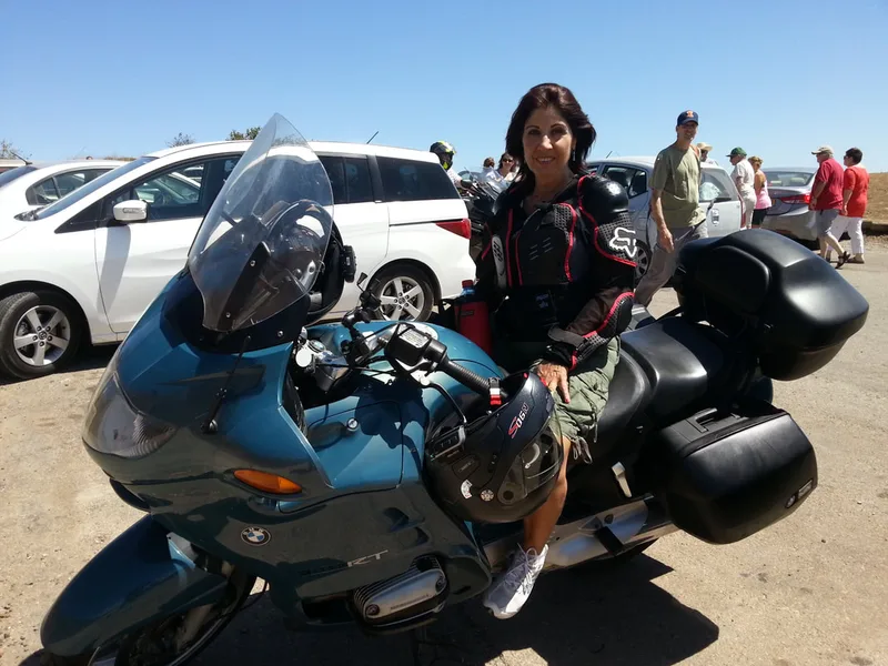
If you are coming in the months of spring-summer-autumn, snow is something that you won't see there. But you will enjoy a thrilling road up and down the mountain, with nice curves, a stunning view from the top, and probably a gorgeous Druze meal in Majdal Shams. Also, in case you took your time in the previous stops and get to the Hermon near the end of the day, Majdal Shams has some nice new hotels where you can enjoy the best of Druze hospitality.
Below you can see pictures of Mt. Hermon in the winter and in the summer, and the map to get there.
From Nimrod Fortress we will continue through road 989, pass through the Neve Ativ moshav, continue through the road until the Druze city of Majdal Shams, and from there up to Mount Hermon.
Mount Hermon is the pearl of the Golan Heights. With its 2,040 meters of height, it is the highest mountain in Israel and can be seen from many places in the area; in clear days one can see from there all the Golan Heights and the Upper Galilee, and sometimes even the Lower Galilee with the Kinneret Lake (aka Sea of Galilee). It is one of the only places in Israel which gets covered with snow during a big part, so naturally is the only Israeli ski resort.
If you are coming in the months of spring-summer-autumn, snow is something that you won't see there. But you will enjoy a thrilling road up and down the mountain, with nice curves, a stunning view from the top, and probably a gorgeous Druze meal in Majdal Shams. Also, in case you took your time in the previous stops and get to the Hermon near the end of the day, Majdal Shams has some nice new hotels where you can enjoy the best of Druze hospitality.
Below you can see pictures of Mt. Hermon in the winter and in the summer, and the map to get there.
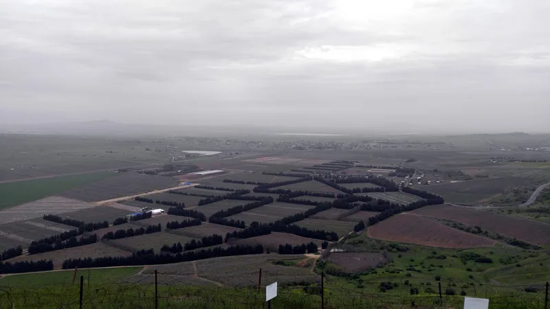
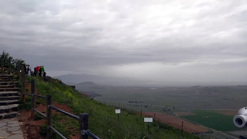
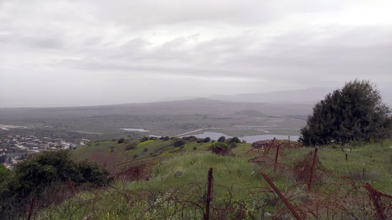
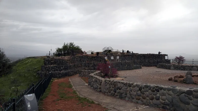
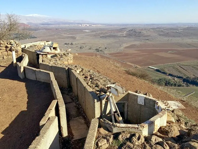
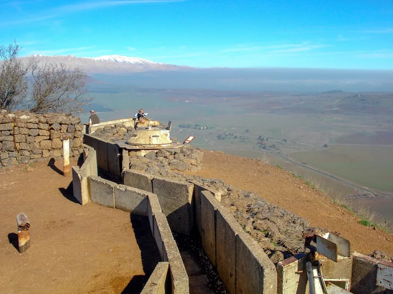
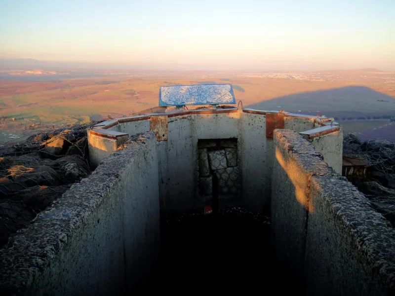
Mount Bental
Being the Golan Heights the land of the mountains, we will now leave Mount Hermon to a visit to another mountain: Mount Bental.
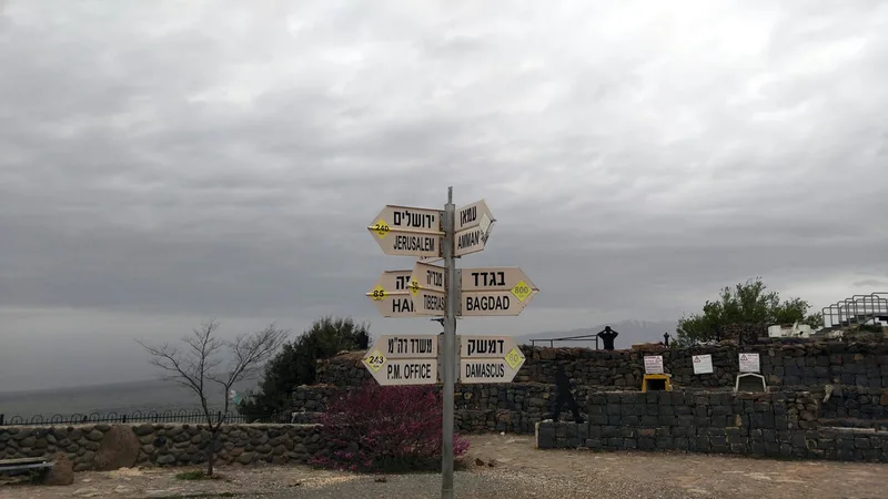
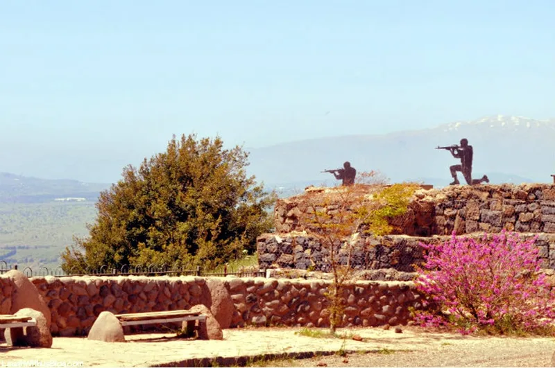
Mount Bental is (or was in the past) a strategic point that controls all the Golan area - from there you can see all movement in all the roads around. In the 1973 Yom Kippur War, the Syrians attacked the area with between 1,000 and 1,500 tanks, while Israel had only 160 tanks there. Despite the number difference, the Israelis managed to destroy nine hundred Syrian tanks, time in which the Syrians panicked, turned back, and returned to Syrian territory. By the time they turned back, only 7 Israeli tanks were left operational. Today, in remembrance of this bloody battle, the valley between Bental and the Hermon is called Valley of the Tears.
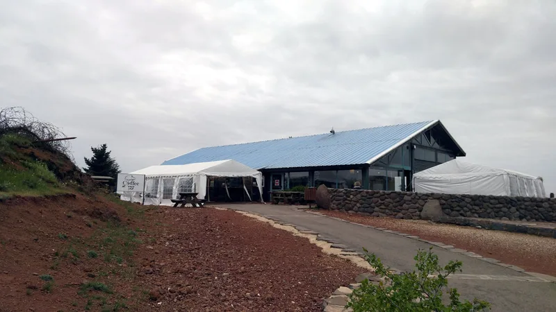
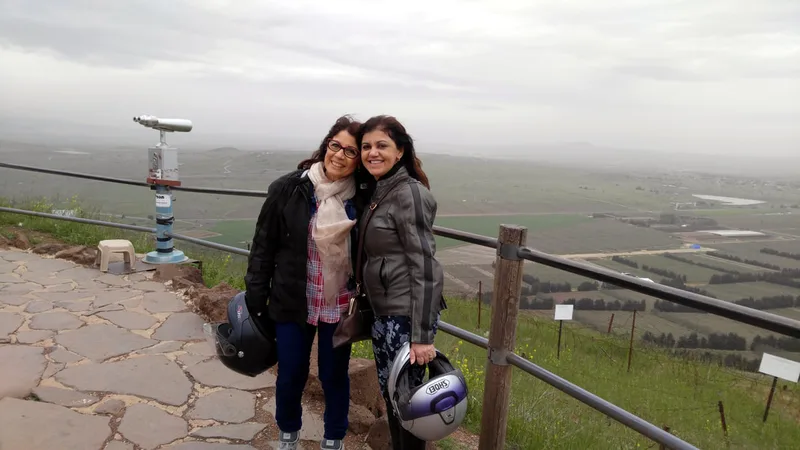
Nowadays, Mount Bental has become a touristic attraction, where at its top people can find the trenches from the time of the battles, signs of distances to different cities of the region, and a nice coffee house called Coffee Anan (a parody mix of the name of the former UN Secretary-General Kofi Annan and the meaning in Hebrew of the name, which means "Coffee at the Clouds").
Leaving Mount Hermon and Majdal Shams, we will ride 29 Km South with Road 98 until we see a sign to turn right to Road 959 in the direction of Merom Golan. We will turn in the direction of Merom Golan, pass through the Bental Reservoir, where there is a nice photograph spot, and then turn left to Road 9882, again in the direction of Merom Golan. We will pass the Kibbutz and continue uphill to Mount Bental, there we will park the bikes and go to the viewpoint to visit the site.
Merom Golan is another option to sleep in the area, the Kibbutz has a nice resort in its area.
Being the Golan Heights the land of the mountains, we will now leave Mount Hermon to a visit to another mountain: Mount Bental.
Mount Bental is (or was in the past) a strategic point that controls all the Golan area - from there you can see all movement in all the roads around. In the 1973 Yom Kippur War, the Syrians attacked the area with between 1,000 and 1,500 tanks, while Israel had only 160 tanks there. Despite the number difference, the Israelis managed to destroy nine hundred Syrian tanks, time in which the Syrians panicked, turned back, and returned to Syrian territory. By the time they turned back, only 7 Israeli tanks were left operational. Today, in remembrance of this bloody battle, the valley between Bental and the Hermon is called Valley of the Tears.
Nowadays, Mount Bental has become a touristic attraction, where at its top people can find the trenches from the time of the battles, signs of distances to different cities of the region, and a nice coffee house called Coffee Anan (a parody mix of the name of the former UN Secretary-General Kofi Annan and the meaning in Hebrew of the name, which means "Coffee at the Clouds").
Leaving Mount Hermon and Majdal Shams, we will ride 29 Km South with Road 98 until we see a sign to turn right to Road 959 in the direction of Merom Golan. We will turn in the direction of Merom Golan, pass through the Bental Reservoir, where there is a nice photograph spot, and then turn left to Road 9882, again in the direction of Merom Golan. We will pass the Kibbutz and continue uphill to Mount Bental, there we will park the bikes and go to the viewpoint to visit the site.
Merom Golan is another option to sleep in the area, the Kibbutz has a nice resort in its area.
Golan Heights Winery
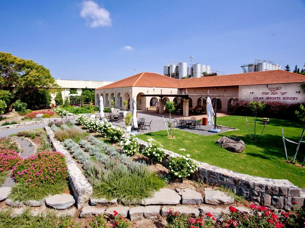
If we are interested in visiting wineries, learning about the wine preparation process, and tasting distinct types of wines, the Golan Heights Winery will be our next stop.
I must add here, the Golan Heights are full of small boutique wineries, but this one is one of the best in Israel, having won international prizes. Additionally, it has a genuinely nice visitor center.
Here, there is not much to say. Enter the visitor center and have a guided tour. It would be recommended to call them at least one day before getting there at +972-4-6968435 to reserve the tour.
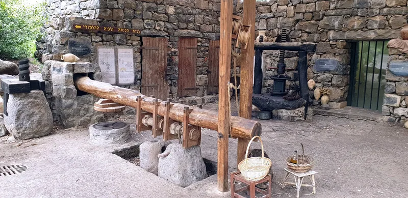
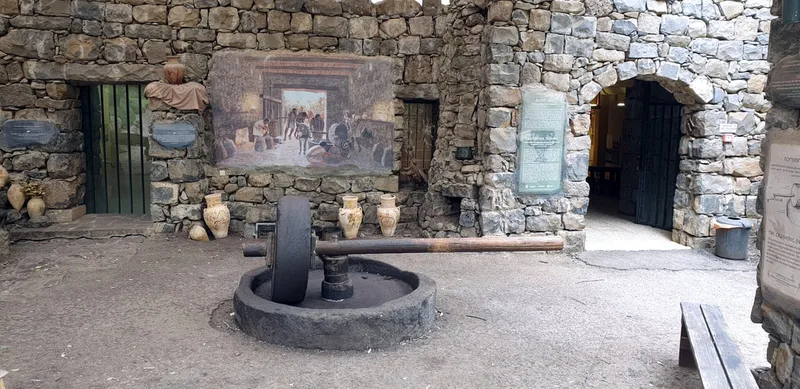
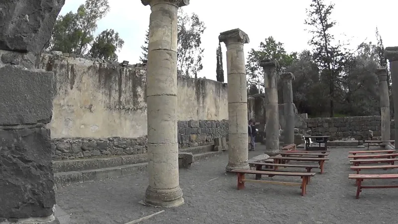
Qatzrin Old Synagogue and Ancient town
Since at this moment you might have some wine in your brain, we will do only a short ride of 850m until our next visit point: the old synagogue and the Talmudic Town of Qatzrin.
Qatzrin is nowadays a city in the Golan, but it has at one of its corners the remains of the ancient Talmudic town (dating 70-500 CE) and its old synagogue.
There you can go on a beautiful walk, get acquainted with some of the history of the place and get your mind clear to continue riding.
Ani'am
Our next stop is composed of two visits.
The name of the place is Ani'am, a small village in the Golan.
We are going to stop at two points in this area:
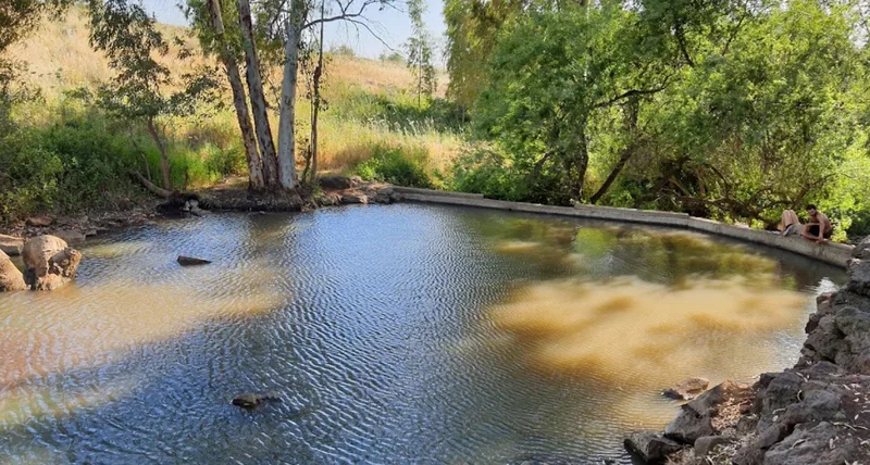
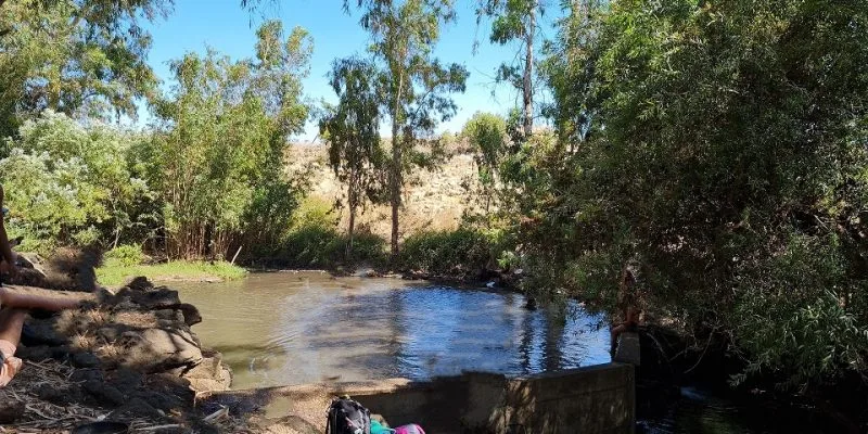
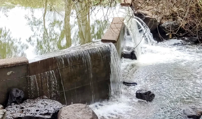
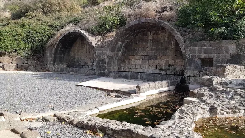
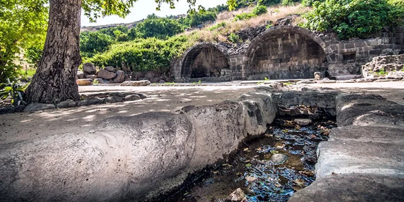
1. Eyn Ani'am is a spring near Ani'am that creates a small lake which is almost unknown. It is there and only a few people stop to see or to bathe in it. The place is adorable, and many people who visit there say it was one of the high points of the tour.
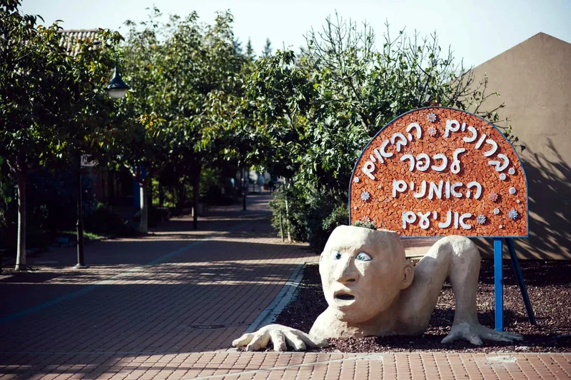
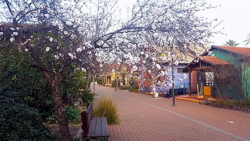
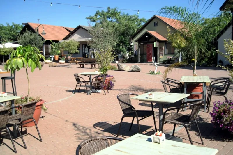
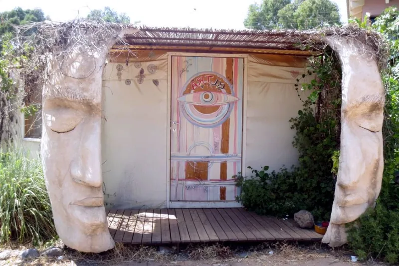
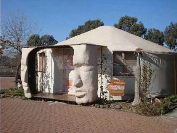
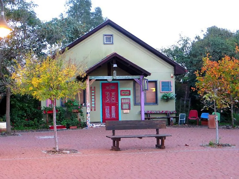
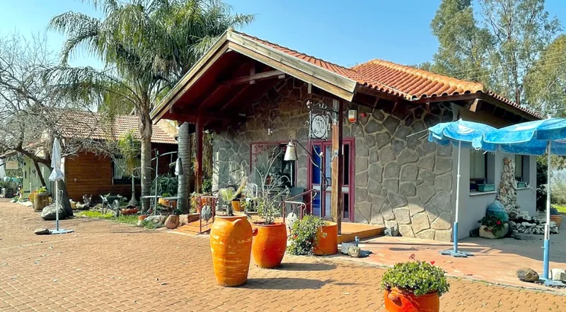
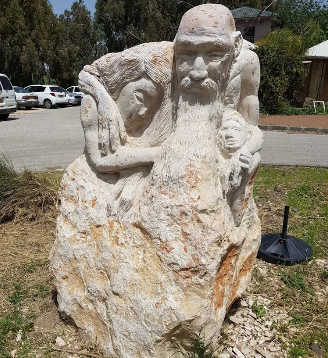
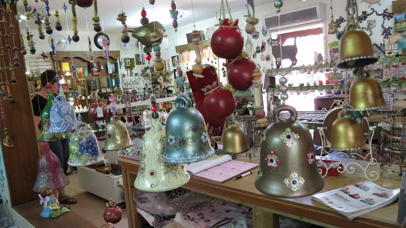
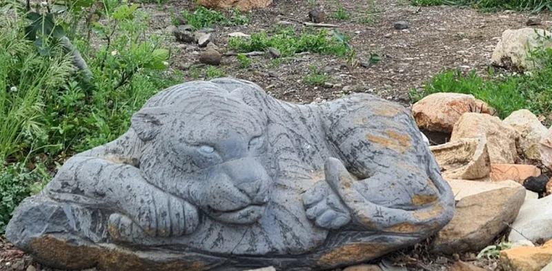
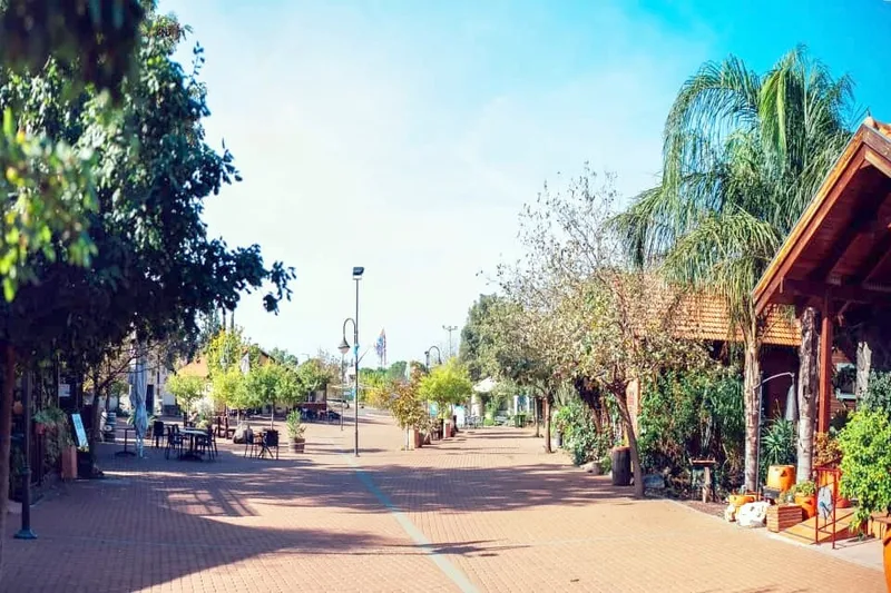
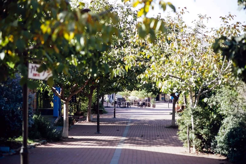
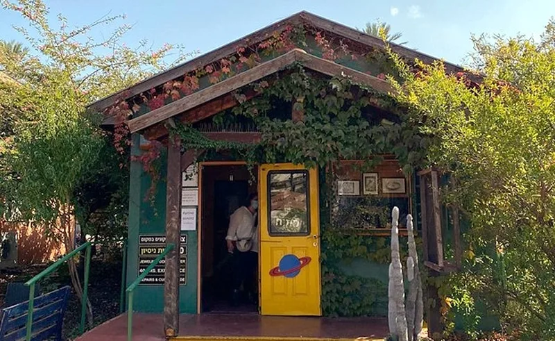
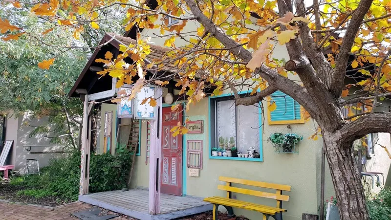
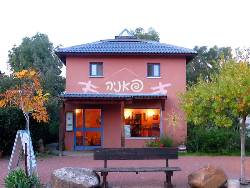
2. The Ani'am Artists Village is what the name says - an artist village. There you can find some remarkably interesting architecture in the houses of the artists, shops with their articles, cafes, etc. It is worth paying a visit there and walking around in the village, even if for a few minutes only.
Our next stop is composed of two visits.
The name of the place is Ani'am, a small village in the Golan.
We are going to stop at two points in this area:
1. Eyn Ani'am is a spring near Ani'am that creates a small lake which is almost unknown. It is there and only a few people stop to see or to bathe in it. The place is adorable, and many people who visit there say it was one of the high points of the tour.
2. The Ani'am Artists Village is what the name says - an artist village. There you can find some remarkably interesting architecture in the houses of the artists, shops with their articles, cafes, etc. It is worth paying a visit there and walking around in the village, even if for a few minutes only.
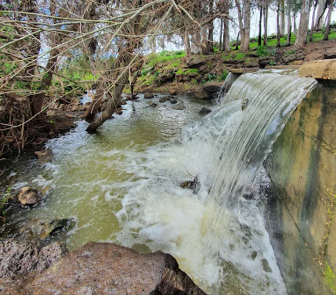
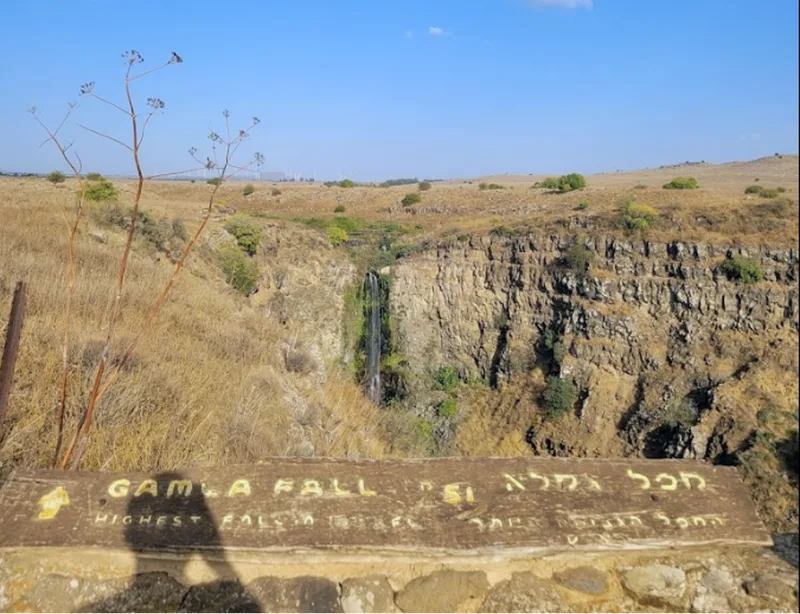
Gamla Waterfall
At a distance of 10 minutes from Ani'am we will find another famous waterfall at the Golan Heights - Gamla Waterfall.
To get there, all you must do is to leave Ani'am, turn right (South) in Road 808, travel around 8 minutes and then turn right again to exit the main road and enter the Gamla Natural Reserve.
Actually, Park Gamla is not only composed of the waterfall - but we do have three things to do there according to our interest:
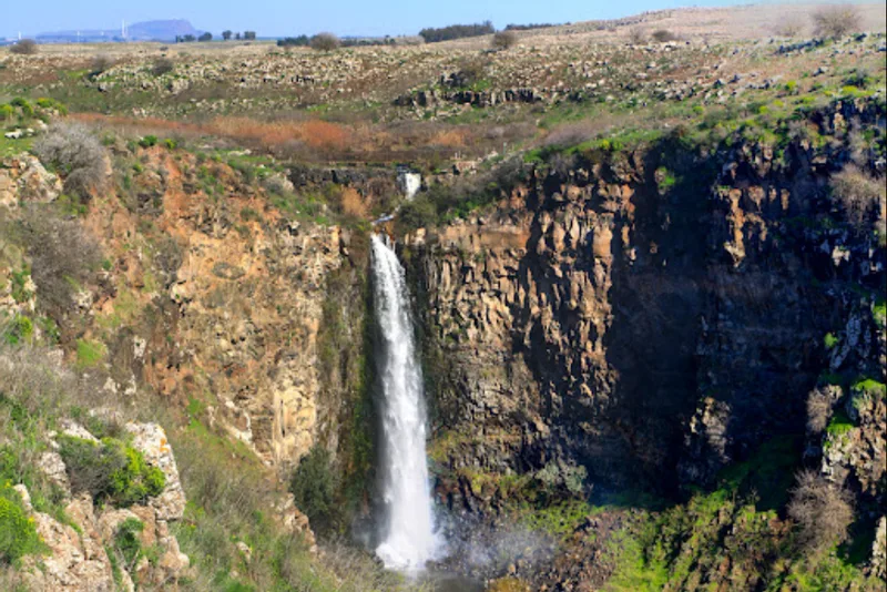
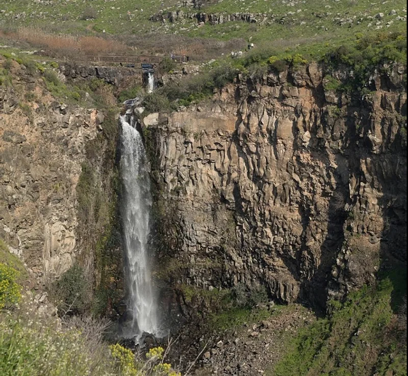
1. The waterfall: one of the highest waterfalls in Israel (if not THE highest), which can be seen from a viewpoint at all its splendor.
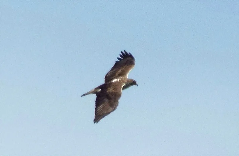
2. The birdwatch: the birdwatch point faces the mountains where the nests of the Gamla Eagle are. If you have enough patience, you can see this beautiful bird flying around.
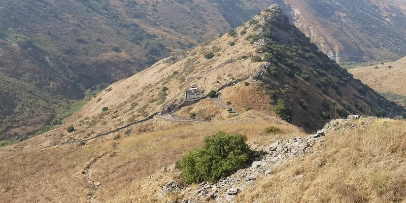
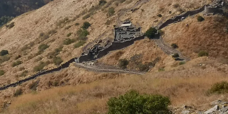
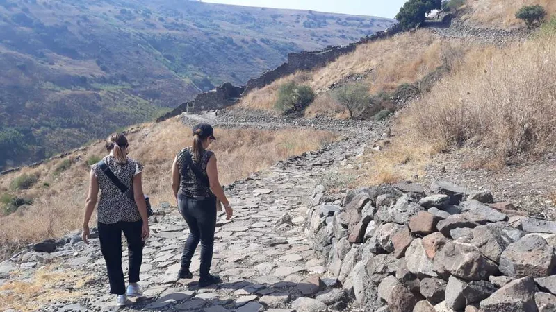
3. Gamla Ancient Town: once there was an ancient town in this area, and its remains are still there to be explored by the visitors
All in all, the park is exceptionally beautiful and a pleasure to visit. Recommended.
At a distance of 10 minutes from Ani'am we will find another famous waterfall at the Golan Heights - Gamla Waterfall.
To get there, all you must do is to leave Ani'am, turn right (South) in Road 808, travel around 8 minutes and then turn right again to exit the main road and enter the Gamla Natural Reserve.
Actually, Park Gamla is not only composed of the waterfall - but we do have three things to do there according to our interest:
1. The waterfall: one of the highest waterfalls in Israel (if not THE highest), which can be seen from a viewpoint at all its splendor.
2. The birdwatch: the birdwatch point faces the mountains where the nests of the Gamla Eagle are. If you have enough patience, you can see this beautiful bird flying around.
3. Gamla Ancient Town: once there was an ancient town in this area, and its remains are still there to be explored by the visitors
All in all, the park is exceptionally beautiful and a pleasure to visit. Recommended.
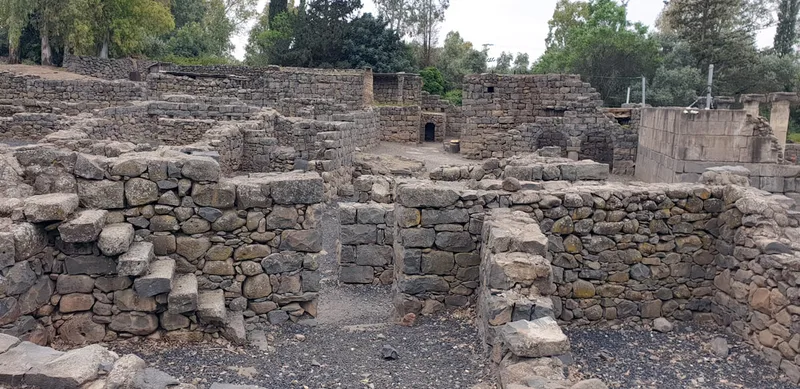
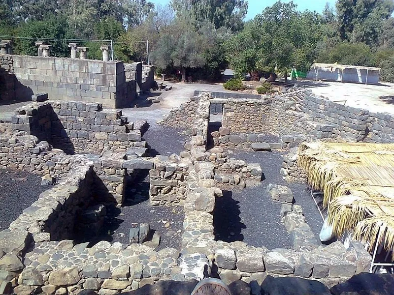
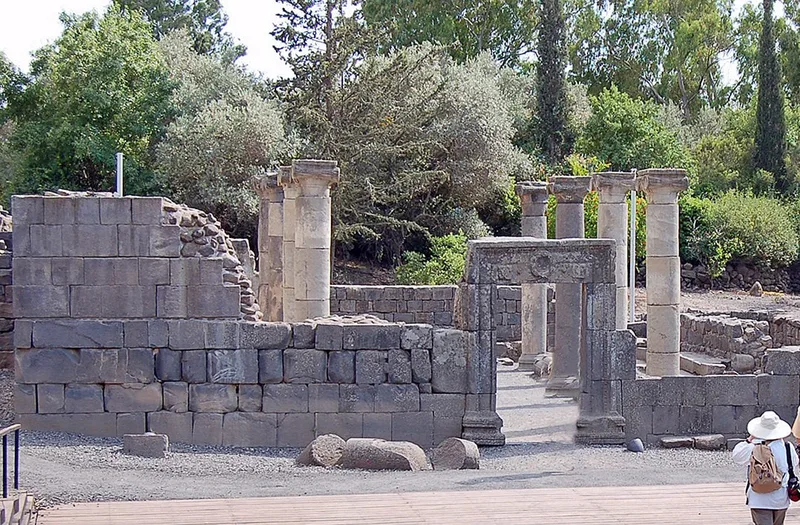
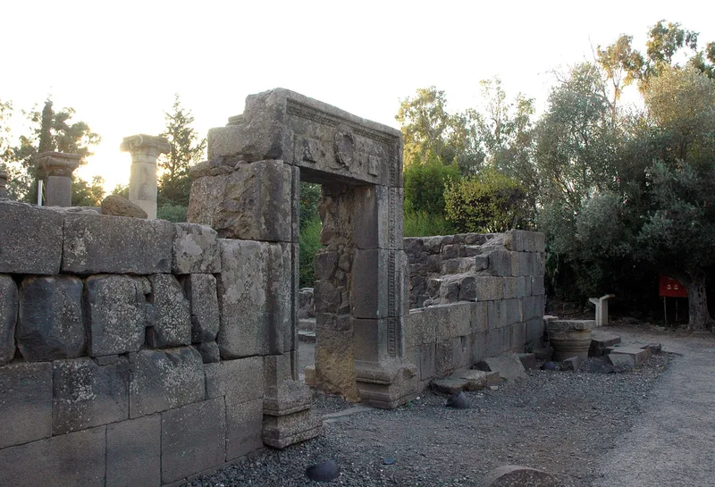
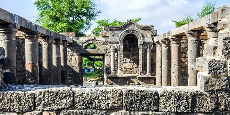
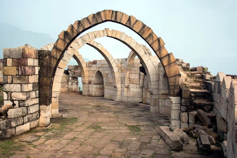
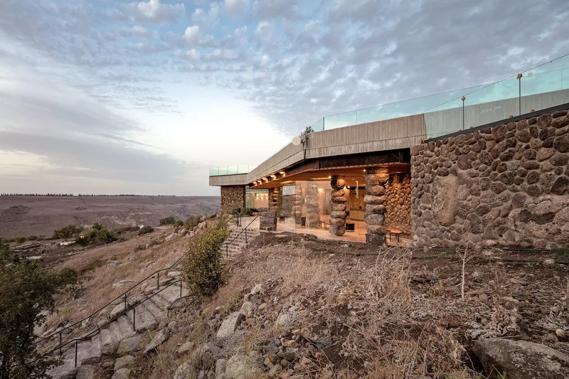
Ein Keshatot Reconstructed Synagogue
Our next stop will be at Ein Keshatot (Um el-Kanatir), another interesting archaeological site. People believe that a rich Jewish community used to live here in the Talmudic period, and they have built an impressively large and rich synagogue. A powerful earthquake in 749 CE destroyed the building, as well as the entire village, which was never rebuilt until recent times.
Around 20-25 years ago the site was discovered and rebuilt through the use of cutting-edge technology, namely stone-by-stone reconstruction (technically known as “anastylosis”). The excavations and the reconstruction took 15 years to be concluded and, after the conclusion, a visitor center was built at the top of the mountain where visitors can see a video explaining the place before climbing down to visit the rebuilt place.
To get there from Gamla Falls, all we need to do is to get out of the park and right (South) on Road 808, and then right again on Road 8691 in the direction of Natur.
The meaning of "Keshatot" in Hebrew is "Arcs", a building form quite common in this region.
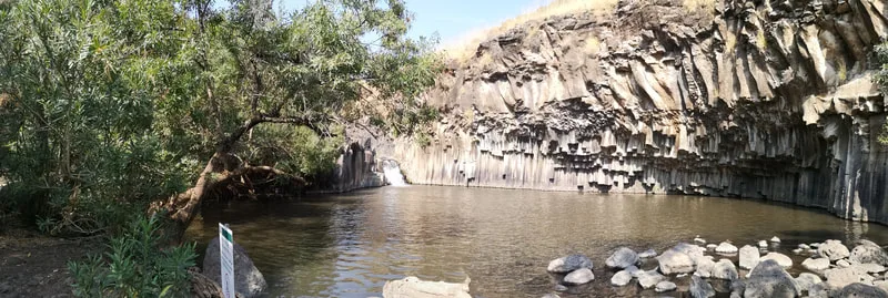
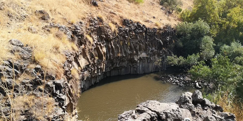
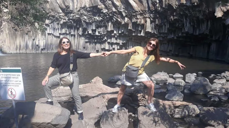
Hexagon Pool
The Hexagon Pool, or in Hebrew Brechat Meshushim is an interesting pool naturally created by the Meshushim river. The pool, at the bottom of a canyon, is named after the shape of the hexagonal basalt columns that make up its walls. This geological formation was created by the slow cooling of layers of lava flows over an extended period. When the lava solidified and cooled, it was split into polygonal shapes due to its contraction. Despite the impression it gives that it is man-made, the walls are completely a work of nature.
To get there we will Leave Ein Keshatot as we arrived to it and turn left (North) at the intersection with Road 808. We will pass Ani'am again and immediately after there we will turn left (West) at Road 869, travelling on this road until its end at the intersection with Road 92. There we will take a right (North) again, and travel until the end of Road 92 and its intersection with Road 87, where we will turn left (West) and then right (North) on Road 888 in the direction of Had Nes. We will pass the village of Had Nes in our right, and then continue in the road for some Kilometers more until the entrance to the Meshushim Reserve. The way seems complicated, but it takes only 35 minutes to get there.
The Mevo Hama to Hamat Gader Road - and Hamat Gader
Prepare your spirit - you are in the way to ride one of the most beautiful roads for motorcyclists in Israel!
The road takes from Kibbutz Mevo Hama to Hamat Gader, another interesting site in the region.
For getting there, we will leave the Meshushim reserve travelling back in the opposite way we came through Road 888, turn left on Road 87 and right on Road 92. We will ride South on Road 92, near the beaches of the Kinneret Lake (Sea of Galilee) until we see a turn left with signs pointing to South Ramat HaGolan, Giv'at Yoav, and in a separate sign the word Afiq. There, we will turn left on road 789 and continue in this road until its end at Road 98 Intersection, where we will turn right (South). We will then pass Kfar Haruv and Mevo Hama, and some kilometers after Mevo Hama we will begin the descent back to the Sea of Galilee in a beautiful twisty road that shows a stunning scenery from the top. The road is twisty and with low-speed curves, and there are sometimes areas (not many) where you can stop to take pictures, so if you see one, take the opportunity because it is quite surely strategically placed. Unfortunately, I don't have pictures of this road, but I managed to find a Youtube video by user EladSi that shows quite well the experience. He shows quite well the experience from a car, so you can easily imagine how you will feel on the bike.
Hamat Gader is another interesting site, as I said. It includes natural hot springs that are very amusable, and in a separate part the largest alligator and crocodile park of Israel. I don't know exactly how many, but we are talking about thousands of animals. The crocodile park is more of an amusement for children, while the hot springs are good for all ages. The place has lately been renewed and can be the place to spend even half a day. They also have a hotel in case you would like to spend a night there.
End of the Golan tour - Tiberias - at the border of the Sea of Galilee
At this point, we are almost at the end of our Golan Heights tour - which may have taken 1, 2 or 3 days depending on the number of stops and the time you have spent on each of them. At the moment we leave Hamat Gader, we will move almost immediately to the region called the Lower Galilee, which is the area around the Kinneret Lake, aka Sea of Galilee.
I will not give many details now about this area and leave it for the next article - about you probably will need where to sleep. For this purpose, the best place to look for is the city of Tiberias, which is known for having an enormous number of hotels of all categories. There is also the option of Karei Deshe, a comfortable youth hostel where you can get private rooms at a particularly good price. Additionally, all the Kibbutzim near the Kinneret Lake have hotels or Zimmers that you can rent.
Next article: The Lower Galilee.
See you there.
See you there.
2 Comments
It was interesting to read about the riding experience in the Golan Heights. I’m sure this trip offers an amazing view of the region. Do you have any additional riding trail recommendations in the area? If you’d like to learn more about ReactJS, <a href="https://jakarta.telkomuniversity.ac.id/en/reactjs-definition-features-benefits-how-it-works-and-advantages/">Click here</a>.
The Golan heights have many roads running in parallel which can be interesting. Here in this article, I chose the ones I enjoy most and believe that they can be the most interesting for touring motorcyclists. They have the best views, the nicest curves and the most interesting places to stop. But nothing prevents a rider to stop at Katzrin or one of the country hostels in the area and take some days visiting around. There are lots of activities (paid) like chocolate making workshops, manual works, etc, and national parks to visit.